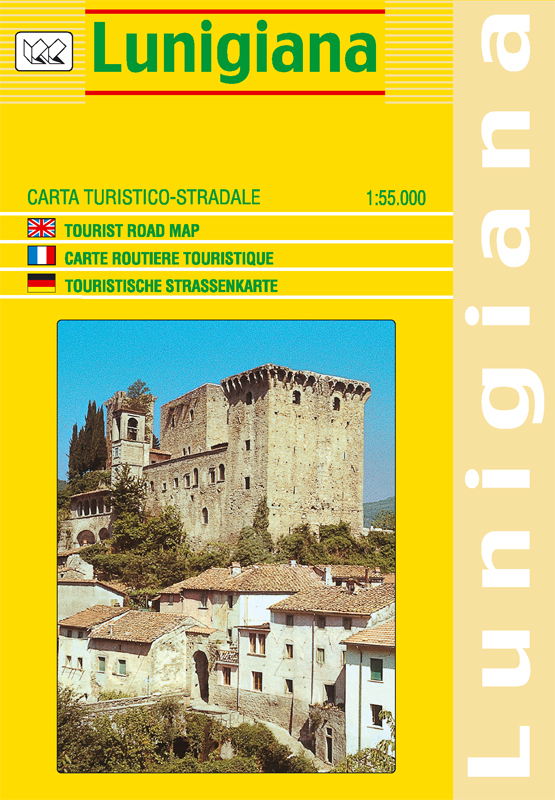
This detailed map of Lunigiana, on the the north west tip of Tuscany covers the area north of the village of Fosdinovo and the La Spezia to the San Stefano motorway interchange between the A12 and A15.
Roads are clearly marked and differentiated according to type and driving distances shown for the main routes with local country roads, tracks and paths also marked. Relief shading is also included together with spot heights. The map also shows railway lines and stations together with other useful information including campsites.
Key: Italian, English, French & German
ISBN/EAN
978 1 85879 6598
Scale
1: 55,000
Format
Folded Map
Publisher
Litografia Artistica Cartografica
Stock Status: In Stock
Reviews (0)
Reviews
There are no reviews yet.
Be the first to review “Lunigiana (Tuscany) | Regional Road Map | 1: 55,000 | LAC” Cancel reply


Reviews
There are no reviews yet.