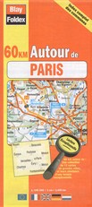
Paris District Map | 1: 145,000 | BLAY FOLDEX
£5.95
Stock Status: In Stock
Description
Description
This map is one of the ‘60km Autour de’ (60km Around) series of maps by French cartographer Blay Foldex, which cover the suburbs of the major French cities. The mapping is exceptionally clear and easy to read, with the road network and tourist attractions clearly marked, and each map comes with a useful town index.
Towns covered: Beauvais, Chartres, Évreux, Évry, Fontainbleau, Meaux, Melun, Paris, Pontoise, Rouen, Versailles
| ISBN/EAN | 978 1 85879 3078 |
|---|---|
| Scale | 1: 145,000 |
| Format | Folded Map |
| Publisher | Blay Foldex |
Reviews
There are no reviews yet.